Stoke
Residents Association
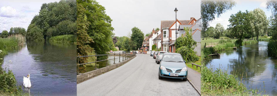
"Don't Choke Bishopstoke"
|
|
|||||||||
|
Stoke Residents Association: Guide To Responses to the proposed Eastleigh Local Plan.
|
Share your views about the proposed Local Plan options for development with Eastleigh Borough Council (EBC) by 5pm 17th February 2016. The best way to influence the Council at this stage in the process is to write, email or use their online form (a “representation”). These are taken more seriously than petitions or standard letters. Every representation has to be read as part of the public consultation process. You can find out how to do this at www.eastleigh.gov.uk/lp36
The EBC
online form doesn’t give much
space for your representation –
but you can add pages, write a
letter instead or simply send an
email: o Email to localplan@eastleigh.gov.uk Encourage your neighbours, friends and family to do the same. The more representations made, the greater the impact. New housing is needed in Hampshire - but it should not be built at the cost of our countryside for future generations. Option B will impact Bishopstoke & it is important that our opinions are considered. At Stoke Residents' Association, we want you to have your say about the proposed Local Plan options- whatever your views. We’ve been digging into the key issues – and here are our group’s conclusions that you might find interesting when writing your own representation. Question number refer to specific questions in the “Issues and Options” document as do page numbers. Page 9, Q1: Summary of the Characteristics of the Borough · The description seems accurate, especially that the countryside between settlements in the borough is locally significant. Page 11, Q2: Does the research listed on the website covers everything needed in the Local Plan? · The research listed appears to exclude input from the Campaign for the Protection of Rural England (CPRE), Network Rail, RSPB, Southern Water, Hampshire and Isle of Wight Wildlife Trust and from the Woodland Trust. Page 14, Q3: Key Strategic Issues · There is no mention of the link between the countryside and local people's quality of life. Environment is not separate from community. · A greater emphasis on affordable homes should be considered. Page 15, Q4: Key Development Constraints · Local Green Spaces, Special Areas of Conservation, Sites of Importance to Nature Conservation and SSSIs should be listed here as should Sites of Ancient Natural Woodland. The area is close to the South Downs National Park. Page 19, Q5: Views on a new vision for the Local Plan · It is disappointing that there is no mention of biodiversity or the countryside. Page 24, Q6: Housing Number Estimates · CPRE have examined the housing numbers in some detail and we have found their assessment very useful. CPRE address the criticism from the Planning Inspectorate referred to in point 5.5. Subsequent to the decision, data has been calculated by the Office for National Statistics (ONS) from the 2011 Census showing that although population in Hampshire had increased, the increase in the number of households was considerably lower than expected, suggesting that the long term decline in household size has “come to a halt”. · They conclude that 13,800 homes between 2011 and 2036 is “the most up-to-date, the most robust analysis of the population 2015 data from ONS, and the one most closely consistent with the household projection methodology as espoused by DCLG.” DCLG is the Department for Communities and Local Government. · With 10,000 new homes are already in the pipeline under current planning, this would mean 3,800 additional homes. · It is very disappointing that the number of houses required was not more accurately defined before the consultation, as this makes it impossible for members of the public to decide which combinations of estimates A to H would be preferred to meet housing need. The higher estimated numbers result in no choice, as all options, in effect, would be required. More clarity is required before further any further consultation. Page 32 Option A Q10: new major road from Fox & Hounds to Bishopstoke Lane. Although we understand that the road improvements shown on this plan are “indicative”, there are concerns: o This will separate the Woodland Trust’s Upper Barn Copse and Crowdhill Copse. This seems to run counter to policy of allowing corridors between key green sites – and as both these are sites of ancient natural woodland, this is of major concern. It will impact biodiversity and the ecological value of both copses - Dormice have been sighted in this area. o The road is shown joining onto Bishopstoke Lane, increasing traffic down this single lane route. We have been informed by Eastleigh planners that this is an error and the road should be shown as per Option B but this needs clarification. We doubt that a bypass north of Bishopsoke would be required as part of this Option. o Full costings are not shown in the Plan or in the associated transport document which makes assessment of what infrastructure this Option could deliver impossible. It is very doubtful that this Option could fund all the new road infrastructure shown through developer funding. This needs further work to show costed prioritised infrastructure that could be delivered – roads, schools, health centres etc. o With such further work Option A might tentatively be considered the lesser evil sharing the burden more evenly across the district. Page 33 Option B, Q11: · By eradicating the gaps between Bishopstoke and Fair Oak, it seems that Option B will reduce the distinctiveness of both villages, transforming the area into one large area of housing with Stoke Park Woods as an island in the centre. It is difficult to see how the character of the villages will remain. · The map shows an area including Sites of Ancient Natural Woodland, attractive countryside, a Site of Special Scientific Interest (SSSI), and Sites of Importance for Nature Conservation (SINCs). o The stream in the area feeds into the Itchen and its wildlife includes otters. o Wildlife in this are includes water voles, great crested newts, dormice, kingfishers and several species of bat. o Any development will have major impacts on ecology and biodiversity in the area. o The Hampshire and Isle of Wight Wildlife Trust should have been consulted before outlining any local development planning options. o Although Stoke Park Woods are not shown as being developed, they will be impacted. It will be difficult to find any spot in the woods where housing is not visible. It will transform the woods from semi-rural to suburban in character. · 6 miles of footpath and bridleway look as if they will be converted to roads and paths through housing estates – considerably less appealing than at present for outdoor activities. o This countryside is greatly valued by local residents for walking, cycling and running - it enables us to enjoy the great outdoors with benefits for our health and well-being. o Removing these key amenities for exercise and connection with the natural world seems to run against the council’s stated aims for a “Green Borough” and “Healthy Community”. · Access to the countryside and woodland is cited by many residents as a major benefit of living here. Destroying this asset will mean that future generations will not be able to enjoy it as we have been able to. · Parts of the zone are subject to flooding. o A developer submitted plan shows housing actually on the Fish Farm – an area of ponds that floods frequently. This would also destroy a local business, depriving local people of their livelihoods. o The road, as shown, would require culverting, and could be likely to increase the risk of flooding if not maintained rigorously. o Woodlands must be protected as they play an important role in reducing the risk of flooding. · The new road will primarily serve the new housing – not current residents. There will be increased traffic & congestion (increasing pollution and safety issues) on Church Lane, Underwood Rd, Rogers Road & Stoke Common Rd. o The road will have a detrimental impact on Highbridge residents who should have been more involved in this consultation. o The additional documents show that the cost of this road will be £22M. It would be interesting to know why EBC finds this more attractive than the £15M option that is closer to Colden Common. All three of the road options have the same issues already outlined. o We would like clarification whether the estimated road costs are accurate. Do they include road stabilization through made ground for example as the route is shown crossing filled gravel pits? Do they include the significant improvements that would be required to the railway bridge at Allbrook – and to deal with the regular flooding of the road in this area? o We would also like to see more detailed plans showing how the road would cross and intersect with Bishopstoke Lane. Page 37, Q12: Option C · Like Option B, Option C destroys countryside. By building right up to the borough boundary, gaps are not respected between settlements. · Most of the arguments against Option B already stated also apply to Option C. · If Option B does not go ahead, Option C may still need road improvements to avoid increasing congestion. · New roads should not be routed through ecologically important sites – including between Upper Barn Copse and Crowdhill Copse. o It would appear that Option C is not an extension to Option B but the reverse. Option C will require transport improvements – these could include the road shown in Option B. B and C are, in effect, one option. Indeed, it appears to be the same developer. Page 40, Q13: Option D · If it is demonstrated that the housing numbers require very high levels of development, this option seems less potentially damaging than some of the other options. But as it still destroys countryside, the housing number estimates will need to be robust to justify this Option. · This could be done with less impact on gaps between settlements than Options B or C. Green gaps would be required south of Bishopstoke and Fair Oak. · This area already has industrial and commercial use. · However, considerable work would be needed to demonstrate how the transport infrastructure would work – motorway and railway as well as major roads. A new station on Allington Lane could be considered. · Much of this area is subject to flooding which would need to be assessed very carefully. Page 48, Q17: Option H · The Chickenhall Link Road was promised to local residents when Southampton Airport was built and many locally would really welcome Option H. o Businesses on the industrial estates would benefit significantly from better transport links to the M27 and the airport. o It would help to reduce air pollution in Eastleigh centre as trucks and traffic could access the industrial units from the south. o It could also ease congestion on Bishopstoke Road and in central Eastleigh. Page 48, Q18: Have all spatial options been considered? · There is no mention of empty homes in this document. The council should aim to address all empty homes and vacant second homes if it is to maximise housing numbers in a way that improves the borough. · Based on the most recent data, there are 255 long term empty homes in the Borough. Homes become empty for a number of reasons – 255 is a “snapshot”. If 50 per year are resolved with an effective strategy, that would be 1,000 homes added to the Borough by 2036 – and all would be within the current infrastructure. Page 50, Q19: Which approaches to the countryside do you think are most appropriate? · Eastleigh should be placing greater value on the remaining countryside it has and continue with the presumption against development. · It plays an important part in the quality of local people's lives and wellbeing. · The Hampshire and Isle of Wight Wildlife Trust should have been consulted before outlining any local development planning options. Page 52, Q20: Do you think gaps still play a part in Eastleigh? Was the approach in the previous Plan sound? Should we review gaps to retain only the minimum land required to maintain separate identity? · Gaps between settlements are important to retaining distinctive character. Gaps should not be "minimised" as they provide essential breathing space in an increasingly urbanised, built-up area. · Combining the gap policy with the countryside policy seems the soundest option. Page 56, Q22: Which approach to the thresholds over which affordable housing will be sought do you think is more appropriate? · Reduce the threshold to 10. Affordable housing is the most needed category of housing – but it is worth considering even at “affordable” levels, young people are finding it increasingly difficult to buy their first home. Page 56, Q23: Which approach to the proportion of affordable housing to be sought from qualifying developments do you think? · The proportion of affordable housing in all new developments should be increased if the aim is to make housing more accessible to meet local housing needs. Page 63, Q27: Do you agree with any of the approaches identified for influencing building standards and density of development? · Housing standards should be used to ensure that residents enjoy the highest possible quality of life. Homes should be affordable to run and be adaptable to changing needs. · The BREEAM excellent standard should be a minimum for all developments. Page 68, Q68: Which approaches to addressing transport issues do you think are most appropriate? · Cycling and walking should be supported more throughout the Borough. · Continuous off road cycle ways should be provided on routes north through to Winchester and south to Southampton – and between Fair Oak and Eastleigh. · Trains should be considered. Many local people commute by rail. Page 70, Q31: Which approaches to delivering and protecting Green Infrastructure do you think are most appropriate? · Green space is essential to quality of life. There should be no development that reduces this. · There should be no development that degrades Sites of Importance for Nature Conservation, Sites of Special Scientific Interest or sites of ancient natural woodland. · Local Green Spaces should be identified, recognised and protected across the borough. The Hampshire and Isle of Wight Wildlife Trust should have been consulted before outlining any local development planning options. Page 72, Q32: How should we provide for sustainable urban drainage systems in the future? · No building should take place on land that is subject to flooding. · The management of surface water is a good argument to leave the borough's countryside as green space & not developing it. Woodland plays an important part in preventing flooding so should be protected. Page 73, Q33: Are there any approaches, other than that described in the previous Local Plan, to address pollution issues in the future? · Yes. For air pollution, Eastleigh BC should adopt a Low Emissions Strategy: http://www.lowemissionstrategies.org/ This would focus on reducing air pollution levels overall by targeting a number of measures including encouraging low emission vehicles rather than focusing exclusively on congestion relief for the air quality management areas. Page 74, Q34: How do you think we should meet the future needs for sporting facilities within the borough? · Sport also needs green spaces - for example, runners use the footpaths and bridleways around the borough for training and for fitness. · Being able to walk in the countryside does much to improve the health for residents. Page 77, Q36: Do you have any comments on the proposed approach to addressing future nature conservation issues? · Protecting natural habitats supports wildlife - and people benefit too. · No development should be allowed that impacts any site of nature conservation, sites of special scientific interest or sites of ancient natural woodland. · The Hampshire and Isle of Wight Wildlife Trust should have been consulted before outlining any local development planning options. Fini. |